
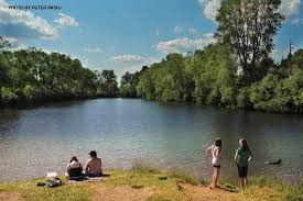
Clean water emerged as Salmo’s priority asset in the recent Sustainable Salmo asset mapping process. Protecting the Village’s pristine water supply is a priority for community members both now and into the distant future.
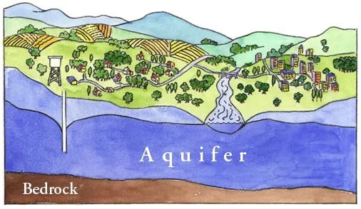
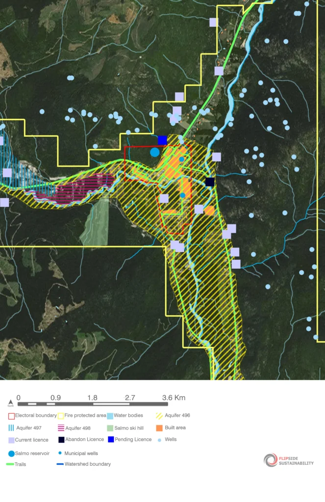
The Village of Salmo is fortunate to have three aquifers either resting below or near its boundaries. Aquifers 496, 497 and 498 are natural underground reservoirs that hold groundwater and provide pristine water to our wells and springs (see aquifer map below).
The Village relies 100% on the groundwater supply from aquifer 496, which is pumped from two main Village wells, Sayward and Glendale (blue dots on the map below).
The water is pristine and untreated, providing residents with all the health benefits associated with pure groundwater. Another benefit is the significant infrastructure savings associated with water delivered directly to homes rather than through an expensive water treatment plant.
It is important to note that aquifer 496 is a vulnerable aquifer. This means that the aquifer is hydrologically connected to surface water and fluctuates with the water table. It also means that it is prone to contamination from surface sources.
Our aquifer provides us with top quality potable water, as well as ecosystem services including water purification and water storage.
We must begin today to work together to prevent contamination from surface sources and to limit our water use especially during dry, peak demand periods. Some key things to consider are:
In December 2017, the Village received a Source Water Protection report (a hydrogeological assessment of the aquifer) prepared by Waterline Resources Inc. The Village plans to undertake further studies of the aquifer in coordination with the RDCK to establish more precisely how the aquifer is replenished and to understand winter and summer volume in order to support ongoing groundwater protection strategies.
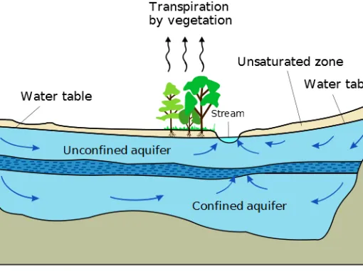
Aquifer 496 is hydraulically connected to surface water, which means that aquifer recharge occurs mainly by rainfall and snowmelt from nearby upslope streams, creeks, and rivers. Due to its unconfined nature and connection with surface water, this aquifer is highly vulnerable to contamination from surface sources and requires thoughtful stewardship.
Aquifer 497 is likely hydraulically connected to Erie Lake in some locations, which could influence aquifer recharge during certain times of the year.
Aquifer 498 is likely hydraulically connected to Erie Creek in some locations, which could influence aquifer recharge during certain times of the year.
Contact
Ph: (250) 357-9433
Fax: (250) 357-9633
Email: info@salmo.ca
Hours
Monday to Friday:
8:30 am – 4:30 pm
Closed: 12:00 pm – 1:00 pm daily